products
Contact:
Monitoring
Geotechnical Solutions
Efficient . Proven . Comprehensive
 Software- and surveying-solutions with flexible and professional graphics.
New standards for efficient measurements and comprehensive graphics
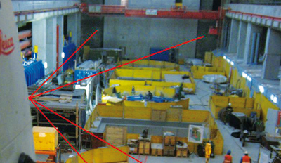
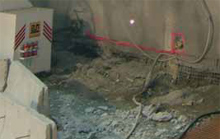
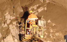
Axis3D geotechnical solutions include field and office software for the measurement, analysis,and graphical presentation of geotechnical measurements in tunnel and underground engineering.
Efficient Workflows
Proven Methods
Comprehensive Results
 Axis3D software solutions are adapted to tunnel and underground construction workflows, allowing for very efficient project execution. The individual configuration of data structure and an intuitive user interface allow for quick and appropriate reactions to varying requirements on construction sites.
 Axis3D geotechnical software workflows were developed in close cooperation with users.
The products have been used on real construction projects over many years and are continually
refined and improved. They are always state of the art.
Axis3D geotechnical software workflows were developed in close cooperation with users.
The products have been used on real construction projects over many years and are continually
refined and improved. They are always state of the art.
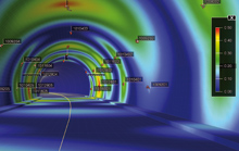 The interpretation of measurement results is greatly simplified by a multitude of graphical illustration options. Graphics are created quickly and easily on-demand, so visualizations are always up-to-date and adapted to the individual project requirements.
Customers
DIBIT Measuring TechniqueRhomberg Sersa Rail Group
Stolitzka & Partner Civil Engineers
Vorarlberger Illwerke AG
for Geodesy and Industrial Metrology
PC | Web | Mobile Systems | Embedded Systems | 3D-Visualization