produits
Contact:
Sets of Angles
Axis3D SET - Sets of Angles
Field solution for efficient sets of angles measurements

Short measuring times: Save time by measuring automatically.
Intuitive user interface: Workflow optimized for fieldwork – developed by surveyors for surveyors.
Smart: On-board software for Leica Geosystems total stations TPS1200, TM/S30, Viva and Nova total stations. No additional hardware necessary.
Reliable: Accuracy information is displayed immediately.
Measurement quality can be checked in the field.
Measure Learning Set
Automatic Set Measurement
Control
 The first set defines the target points and the measurement order. Each point is assigned an individual automatic target recognition (ATR) status, prism and constant, target height, temperature, and humidity value. After setting up the total station (with coordinates), automatic positioning to target points with know coordinates is possible.
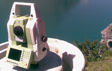 The instrument positions the telescope to the target points as defined in the first set, using the assigned target heights and prism types. Depending on the selected ATR status the points are measured automatically or manually. Points that are no longer available can be skipped.
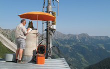 A preliminary adjustment is automatically calculated after completing the sets of angles measurements. Maximum errors and residuals are displayed. Results can be checked in the field and – if required – additional sets can be measured to increase accuracy.
Functionality
Applications
General
- Measurement data stored in ASCII files in Leica GSI8 or GSI16 format, and the the on-board database (Viva and Nova)
- Point coding consistent with other Axis3D products
- Making use of Leica Viva Imaging functionality (coming soon)
- Optional: logging of all activities on the total station
- Program continues after power fail
- Unlimited number of target points and sets
- One- or two-face measurements
- Automatic positioning to points with known coordinates
- Manual positioning to points without coordinates
- Measure entire set with pre-defined target positions (optional)
- Individual automatic target recognition (ATR) status, prism and constant, target height, temperature, and humidity value for each point
- Learning set is not stored as part of the sets of angles measurement
Sets of Angles Measurement
- Measurement method: all points are measured in face one as defined in the learning set, followed by measurements to all points in face two in reverse order
- Automatic positioning to each point. Measurements according to the defined automatic target recognition (ATR) status, prism type, and target height
- The automatic target recognition (ATR) status of individual points can be changed during measurements.
- Skip points that become unavailable
- Automatic preliminary station adjustment after measurements are completed
- Display of maximum residuals for Hz-angle, V-angle, and distance with the affected target point
- Display of mean errors as well as vertical index error
- Measure additional sets based on the learning set (optional)
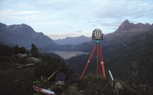 Basic Geodetic Networks
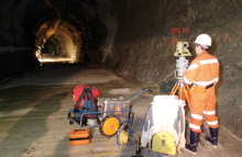 Geodetic Control Measurements
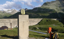 Deformation Measurements
System Information
Hardware
- Leica Geosystems TPS1200 total station
- Leica Geosystems TM/TS30 total station
- Leica Geosystems Viva total station
- Leica Geosystems Nova total station
- Axis3D SET on-board software for Leica Geosystems TPS1200, TM/TS30, Viva and Nova total stations
Related Products
- Axis3D COS - Construction Surveying
- Axis3D GTM - Geotechnical Monitoring
- Axis3D NET - Network Adjustment
Customers
Geodata GroupRhomberg Sersa Rail Group
Vorarlberger Illwerke AG
IVB - Ingenieurgesellschaft
Landesamt Vermessung Bayern
pour la géodésie et la métrologie industrielle
PC | Internet | Systèmes mobiles| Systèmes embarqués | Visualisation 3D